




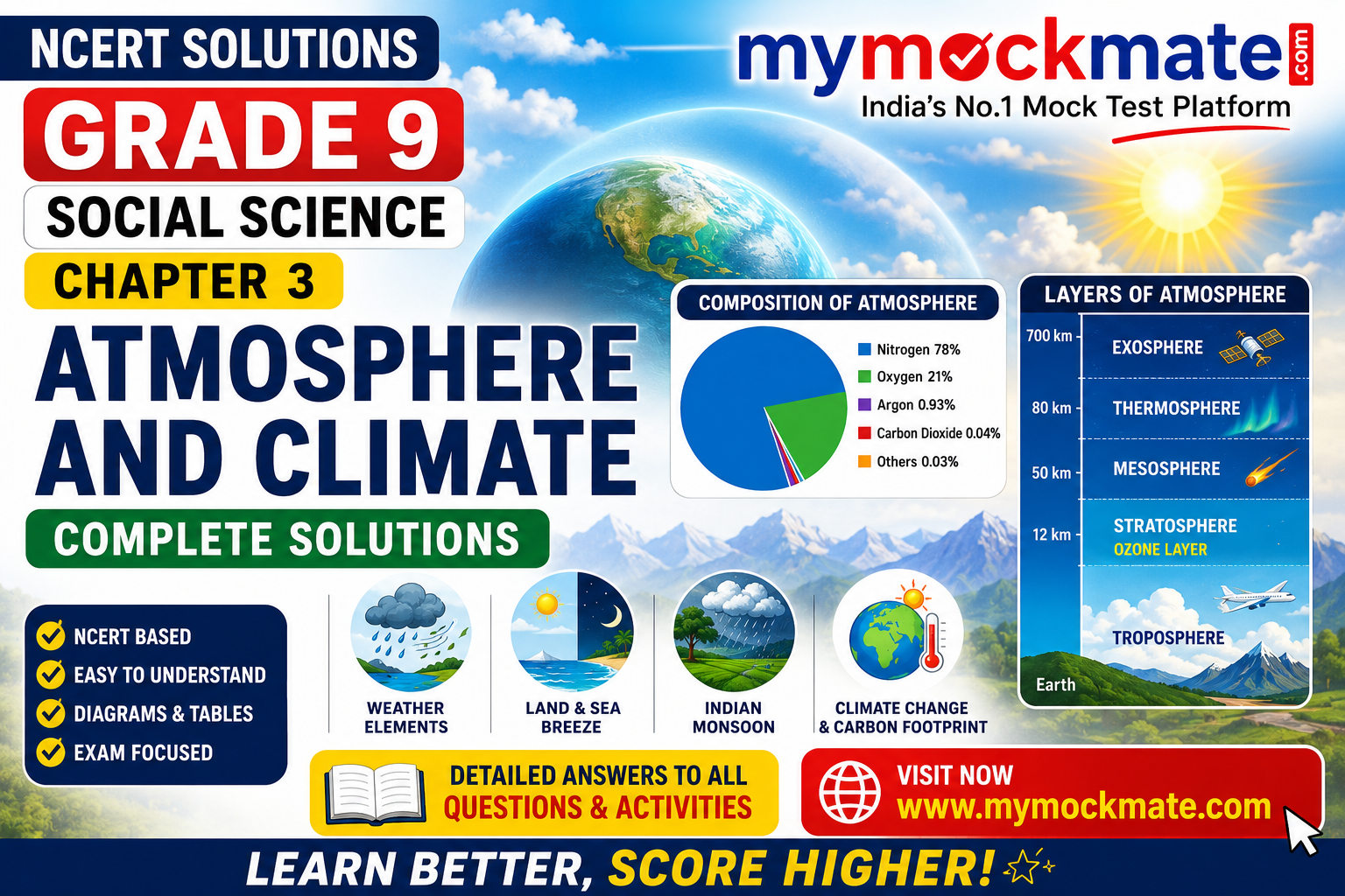

Atmosphere and Climate – Complete Questions and Activities
Short Introduction
The atmosphere is the blanket of gases surrounding the Earth. It makes life possible by providing essential gases, regulating temperature, supporting the water cycle, producing weather, and protecting life from harmful solar radiation.
Chapter 3, Atmosphere and Climate, explains the composition and structure of the atmosphere, elements of weather and climate, atmospheric pressure, wind, land and sea breezes, Indian seasons, the mechanism of monsoon, climate change, and ways of reducing our carbon footprint. The chapter exercise contains questions on these concepts as well as data-analysis activities using temperature and rainfall figures from ten Indian stations.
Quick Information Box
| Particular | Details |
|---|---|
| Class | Grade 9 |
| Subject | Social Science – Geography |
| Book | Understanding Society: India and Beyond, Part 1 |
| Chapter | Chapter 3 |
| Chapter Name | Atmosphere and Climate |
| Main Theme | Atmosphere, weather, climate and monsoon |
| Main Atmospheric Gases | Nitrogen and Oxygen |
| Weather Layer | Troposphere |
| Ozone Layer Location | Stratosphere |
| Major Climate Type of India | Tropical Monsoon Climate |
| Main Rainy Season | South-West Monsoon |
| Major Environmental Issue | Climate Change |
| Learning Resource | www.mymockmate.com |
Concepts Used – Topics Covered
The following concepts are important for understanding and answering the chapter questions:
- atmosphere and its importance;
- composition of the atmosphere;
- nitrogen, oxygen, argon and carbon dioxide;
- water vapour and dust particles;
- vertical structure of the atmosphere;
- troposphere;
- stratosphere and ozone layer;
- mesosphere;
- thermosphere and ionosphere;
- exosphere;
- weather and climate;
- temperature and insolation;
- humidity;
- precipitation;
- atmospheric pressure;
- high-pressure and low-pressure systems;
- wind;
- land breeze and sea breeze;
- seasons in India;
- traditional six-season system;
- south-west monsoon;
- north-east monsoon;
- advancing and retreating monsoon;
- rainfall distribution in India;
- maritime and continental climates;
- effect of relief on rainfall;
- climate change;
- greenhouse gases;
- carbon footprint;
- sustainable lifestyles.
The textbook describes the atmosphere as a life-supporting blanket of gases held around the Earth by gravity and identifies temperature, precipitation, humidity, wind and atmospheric pressure as major elements affecting weather and climate.
Important Formulas and Conceptual Relationships
This chapter is mainly conceptual, but students should remember the following relationships:
Atmosphere = Gases + Water Vapour + Dust Particles
Air Pressure = Force exerted by the weight of air on the Earth’s surface
Wind Direction: High Pressure → Low Pressure
Higher Altitude → Lower Air Pressure
Greater Distance from Equator → Generally Lower Insolation and Temperature
Weather = Short-term Atmospheric Conditions
Climate = Long-term Pattern of Weather Conditions, usually studied over 30 years or more
South-West Monsoon: Sea → Land
North-East Monsoon: Land → Sea, although the winds can acquire moisture over the Bay of Bengal and give rain to the south-eastern coast.
Carbon Footprint = Total Greenhouse Gas Emissions associated with human activities

Questions and Activities – Step-by-Step Solutions
The exercise asks eight main questions, with Question 7 divided into several data-analysis subparts concerning ten representative Indian stations.
Question 1. What is atmosphere? Explain its composition with the help of a pie diagram.
Answer
The atmosphere is the blanket or envelope of air surrounding the Earth. It is held around the Earth by gravity and consists of a mixture of gases, water vapour and tiny dust particles.
The atmosphere is essential because it:
- provides oxygen for respiration;
- provides carbon dioxide for photosynthesis;
- contains nitrogen necessary for the growth of living organisms through the nitrogen cycle;
- protects the Earth from harmful solar radiation;
- helps regulate temperature;
- supports clouds and precipitation;
- produces weather and influences climate.
Composition of the Atmosphere
The textbook diagram gives the approximate composition as follows:
| Gas | Approximate Percentage |
|---|---|
| Nitrogen | 78% |
| Oxygen | 21% |
| Argon | 0.93% |
| Carbon Dioxide | 0.04% |
| Other Gases | 0.03% |
In addition to these gases, the atmosphere contains varying amounts of water vapour and dust particles. Water vapour is important for cloud formation and precipitation.
How to Draw the Pie Diagram
Draw a large circle and divide it approximately as follows:
- the largest sector: Nitrogen – 78%;
- second-largest sector: Oxygen – 21%;
- very small sectors: Argon – 0.93%, CO₂ – 0.04%, and Other gases – 0.03%.
Suggested image placement: Insert a clearly labelled “Composition of Atmosphere” pie chart after this answer. The textbook’s Fig. 3.2 on page 40 is the relevant visual reference.
Question 2. Draw a labelled diagram of the structure of atmosphere.
Answer
The atmosphere is divided into layers according to changes in temperature and density with altitude.
From the Earth’s surface upward, the major layers are:
- Troposphere
- Stratosphere
- Mesosphere
- Thermosphere
- Exosphere
Step-by-Step Explanation
Troposphere:
It extends to an average height of about 12 km. The air we breathe, most clouds and water vapour, and almost all weather phenomena are found here.
Stratosphere:
It extends approximately from the top of the troposphere to 50 km. It contains the ozone layer and has comparatively stable atmospheric conditions.
Mesosphere:
It extends up to about 80 km. Most meteors entering the atmosphere burn up in this layer.
Thermosphere:
It extends roughly from 80 km to 700 km. Temperature rises rapidly with altitude. The ionosphere is part of this region, and auroras occur here.
Exosphere:
It is the outermost atmospheric layer. Air is extremely thin, and light gases such as hydrogen and helium can escape towards space.
Diagram Labels
A good examination diagram should show:
Earth’s Surface → Troposphere → Tropopause → Stratosphere → Stratopause → Mesosphere → Mesopause → Thermosphere → Exosphere
Also mark:
- clouds and weather in the troposphere;
- ozone in the stratosphere;
- aeroplanes in the stratosphere;
- meteors in the mesosphere;
- auroras in the thermosphere;
- satellites in the upper atmosphere.
Suggested image placement: Insert a vertical infographic of atmospheric layers here. The chapter’s Fig. 3.3 provides the visual sequence and approximate heights.
Question 3. Which are the four main seasons of India?
Answer
India has a tropical monsoon climate, and the chapter identifies four main seasons.
| Season | General Period | Main Characteristics |
|---|---|---|
| Winter | December to early April | Coolest period, especially in northern India |
| Summer or Pre-Monsoon | April to June, sometimes July in north-west India | High temperatures and strong heating of land |
| Monsoon or Rainy Season | June to September | Dominated by moisture-bearing south-west monsoon winds |
| Post-Monsoon or Retreating Monsoon | October to December | Withdrawal of monsoon; important rain for south-eastern India |
Detailed Explanation
1. Winter Season
December and January are among the coldest months. Temperatures are lower in north-western India and increase towards southern India.
2. Summer or Pre-Monsoon Season
Strong heating raises temperatures over the Indian landmass. This thermal contrast is important for the development of the summer monsoon circulation.
3. Advancing Monsoon Season
The humid south-west monsoon reaches India and gradually covers most of the country. This is the principal rainy season for a large part of India.
4. Retreating Monsoon Season
The south-west monsoon withdraws from the country. During this period, the south-eastern coast, particularly Tamil Nadu, receives significant rainfall from north-east monsoon winds after they acquire moisture over the Bay of Bengal.
The textbook also notes a traditional Indian system of six ṛtus, but the chapter’s four-season classification is the one asked in this question.
Question 4. Why do you not feel the pressure of the atmosphere?
Answer
We do not normally feel atmospheric pressure because air presses on our bodies from all directions, while the fluids and gases inside our bodies exert an outward counter-pressure.
Step-by-Step Explanation
Step 1: The atmosphere has weight.
Step 2: The weight of air creates atmospheric pressure.
Step 3: This pressure acts on the human body from all directions.
Step 4: The pressure inside the body balances the external atmospheric pressure.
Step 5: Since the pressures are largely balanced, we do not feel atmospheric pressure pushing or crushing us.
The textbook illustrates this balance with arrows showing external atmospheric pressure and counter-pressure from inside the body.
Question 5. In which layer of the atmosphere do aeroplanes fly and why?
Answer
Aeroplanes commonly fly in the lower stratosphere or near the tropopause, because the stratosphere is comparatively stable and is largely free from clouds and major weather disturbances.
Step-by-Step Explanation
Step 1: Most weather occurs in the troposphere.
Step 2: Clouds, rainfall and strong vertical air movements can create turbulence.
Step 3: The stratosphere above it is comparatively stable.
Step 4: Therefore, high-altitude aircraft can travel more smoothly and efficiently in or near this stable atmospheric region.
The chapter’s atmospheric-layer diagram places an aeroplane in the stratospheric region and describes this layer as suitable for aircraft because it is free from clouds and weather disturbances.
Question 6. Distinguish between the following
6(a). Troposphere and Stratosphere
| Basis | Troposphere | Stratosphere |
|---|---|---|
| Position | Lowest atmospheric layer | Above the troposphere |
| Approximate extent | Average height about 12 km | Extends to about 50 km |
| Weather | Almost all weather phenomena occur here | Comparatively free of weather disturbances |
| Water Vapour | Contains most atmospheric water vapour | Much less water vapour |
| Clouds | Most clouds occur here | Generally cloud-free compared with troposphere |
| Temperature Trend | Temperature decreases with altitude | Temperature trend differs because ozone absorbs radiation |
| Importance | Supports life and weather | Contains ozone layer and provides stable flying conditions |
Conclusion
The troposphere is the weather and life-supporting layer, whereas the stratosphere is known for its stable conditions and ozone layer.
6(b). South-West Monsoon and North-East Monsoon
| Basis | South-West Monsoon | North-East Monsoon |
|---|---|---|
| Main Period | June to September | Mainly October onward during the winter monsoon period |
| General Direction | Sea to land | Land to sea |
| Pressure Condition | Low pressure over heated land, relatively higher pressure over ocean | Higher pressure over cooled land, lower pressure over surrounding seas |
| Moisture | Highly moisture-laden | Mostly dry when leaving land |
| Rainfall Importance | Gives most annual rainfall to much of India | Important for south-eastern India |
| Important Regions | Large parts of India | Tamil Nadu and parts of the south-eastern coast |
| Other Name | Summer Monsoon | Winter Monsoon |
Explanation
During summer, India’s landmass heats more rapidly than the surrounding ocean. Low pressure develops over land, drawing moisture-bearing winds from the sea.
During winter, the land cools more rapidly. Winds generally move from the high-pressure landmass towards the sea. When these winds cross the Bay of Bengal, they can acquire moisture and give rainfall to the eastern and south-eastern coast, especially Tamil Nadu and nearby regions.
Question 7. Temperature and Rainfall Data Analysis
The textbook provides monthly temperature and rainfall data for ten representative stations and asks students to analyse their climatic similarities and differences.
Question 7: Prepare Temperature and Rainfall Graphs
Answer and Method
For each station:
- Draw the 12 months from January to December on the horizontal axis.
- Use one vertical scale for temperature in °C.
- Use another vertical scale for rainfall in cm.
- Plot monthly temperature values and join the points with a line.
- Represent rainfall using bars.
- Add a clear title and legend.
The chapter provides a sample graph framework for Delhi in Fig. 3.14.
Broad Generalisations from the Data
The data reveal several broad climatic patterns:
- coastal stations have smaller annual temperature ranges;
- interior stations show greater seasonal temperature variation;
- western Rajasthan receives low rainfall;
- the north-eastern hills receive heavy rainfall;
- Mumbai receives concentrated summer monsoon rainfall;
- Chennai has a different rainfall pattern, with a major peak in the retreating monsoon season;
- Leh is cold and dry because of high altitude and its rain-shadow location;
- monsoon influence is visible across most stations, despite major regional variations.
Question 7.1. Rearrange the 10 stations according to their distance from the equator.
Answer
Arranged from nearest to farthest from the equator, using the latitudes given in the table:
- Thiruvananthapuram – 8°29′ N
- Bengaluru – 12°58′ N
- Chennai – 13°4′ N
- Mumbai – 19° N
- Nagpur – 21°9′ N
- Kolkata – 22°34′ N
- Shillong – 24°34′ N
- Jodhpur – 26°18′ N
- Delhi – 29° N
- Leh – 34° N
Explanation
All these stations are north of the equator. Therefore, the station with the smallest north latitude is nearest to the equator, and the station with the largest north latitude is farthest.
Question 7.2(a). Name two stations with the most extreme climate.
Answer
Delhi and Jodhpur are suitable examples of stations with a strongly continental or extreme climate.
Explanation
Both are inland stations and lack the strong moderating influence of the sea.
Delhi’s monthly temperature in the table rises from about 14.4°C in January to 33.3°C in May and June.
Jodhpur ranges from about 14.9°C in December to 33.9°C in June.
Therefore, both show large seasonal temperature differences compared with coastal stations such as Mumbai and Thiruvananthapuram.
Question 7.2(b). Name two stations influenced by retreating monsoons.
Answer
The clearest examples from the table are:
Chennai and Thiruvananthapuram.
Explanation
Chennai shows a very strong rainfall peak in October and November, characteristic of the retreating or north-east monsoon influence.
Thiruvananthapuram also receives substantial rainfall during the post-monsoon months, although it receives significant south-west monsoon rainfall as well.
Question 7.2(c). Find the two hottest stations in February and June.
(i) February
From the table:
- Thiruvananthapuram: 27.3°C
- Chennai: 25.7°C
Answer
The two hottest stations in February are:
1. Thiruvananthapuram
2. Chennai
(ii) June
From the table:
- Jodhpur: 33.9°C
- Delhi: 33.3°C
Answer
The two hottest stations in June are:
1. Jodhpur
2. Delhi
Question 7.3(a). Why does Shillong experience more rainfall than Kolkata?
Answer
Shillong receives more rainfall than Kolkata mainly because of relief or orographic uplift.
Step-by-Step Explanation
Step 1: Moisture-bearing monsoon winds move towards north-eastern India.
Step 2: The Meghalaya Plateau and surrounding hills force the moisture-bearing air to rise.
Step 3: Rising air expands and cools.
Step 4: Water vapour condenses and produces heavy rainfall.
Step 5: Shillong, because of its elevated relief setting, receives more annual rainfall than Kolkata.
According to the textbook’s representative table, Shillong receives about 225.3 cm annual rainfall, while Kolkata receives about 162.5 cm.
Question 7.3(b). Why does Delhi receive more rainfall than Jodhpur?
Answer
Delhi receives more rainfall than Jodhpur because it is better positioned to receive moisture from monsoon systems, whereas Jodhpur lies in a much drier region of western India.
Step-by-Step Explanation
Delhi:
- receives monsoon rainfall from moisture-bearing systems;
- is influenced by the Bay of Bengal branch moving through the northern plains;
- also receives some winter precipitation from western disturbances.
Jodhpur:
- lies in the arid region of Rajasthan;
- is farther from major moisture sources;
- the Aravalli Range runs roughly parallel to the direction of the south-west monsoon, so it does not effectively force the winds to rise and release much rain.
The table gives annual rainfall of approximately 67.0 cm for Delhi and only 36.6 cm for Jodhpur.
Question 7.4(a). Why does Thiruvananthapuram have an equable climate?
Answer
Thiruvananthapuram has an equable climate because it is located close to the sea and at a low latitude.
Explanation
The sea heats and cools more slowly than land. Therefore:
- summers are moderated by maritime influence;
- winters remain relatively warm;
- the annual temperature range is small.
The textbook table shows monthly mean temperatures remaining roughly between 26°C and 29°C, demonstrating a very small seasonal temperature range.
Conclusion
The maritime influence of the Arabian Sea is the principal reason for Thiruvananthapuram’s equable climate.
Question 7.4(b). Why does Chennai receive more rainfall after the monsoon fury is over in most parts of the country?
Answer
Chennai receives its heaviest rainfall mainly during the retreating or north-east monsoon period.
Step-by-Step Explanation
Step 1: During the retreating monsoon period, winds generally blow from the Indian landmass towards the sea.
Step 2: These north-east winds cross the Bay of Bengal.
Step 3: While crossing the Bay, they acquire moisture.
Step 4: They then reach the Coromandel Coast.
Step 5: Chennai receives substantial rainfall, particularly during October and November.
The table shows Chennai receiving about 30.6 cm in October and 35.0 cm in November, much higher than its summer rainfall in several preceding months.
Question 7.4(c). Why does Leh have moderate precipitation almost throughout the year?
Answer
Leh receives very low but relatively spread-out precipitation through much of the year because it lies in a high-altitude cold desert and rain-shadow region.
Step-by-Step Explanation
Step 1: Leh is surrounded by high mountain ranges.
Step 2: The Himalayas obstruct the moisture-bearing summer monsoon winds.
Step 3: Therefore, Leh receives very little summer monsoon rainfall.
Step 4: In winter and transitional months, western disturbances can bring light snowfall or precipitation.
Step 5: The result is small precipitation amounts spread across several months rather than one very intense rainy season.
The representative data give Leh an annual precipitation total of only about 8.5 cm, making it the driest station in the table.
Question 7.5. Do monsoons provide a strong framework that lends overall climatic unity to India?
Answer
Yes. Despite considerable regional variations in temperature and rainfall, the monsoon provides a strong framework of climatic unity to India.
Step-by-Step Explanation
1. Common Seasonal Rhythm
Across India, people recognise a broad annual cycle of:
- winter;
- hot-weather season;
- advancing monsoon;
- retreating monsoon.
2. Agriculture Depends on Monsoon
The sowing and growth of many crops are closely connected with the arrival and performance of monsoon rainfall.
3. Water Resources Depend on Rainfall
Rivers, reservoirs, tanks, wells and groundwater recharge are strongly influenced by monsoon rainfall.
4. Economic Activities Are Connected
Agriculture, hydropower, rural employment, food production and transportation can all be affected by monsoon performance.
5. Cultural Life Reflects the Monsoon
Festivals, agricultural practices, food habits, literature, music and local traditions frequently reflect seasonal rainfall.
6. Regional Differences Exist within a Shared System
Mumbai receives concentrated summer monsoon rainfall, Chennai receives important retreating monsoon rainfall, and north-eastern India receives heavy orographic rainfall. These differences still operate within the broader seasonal monsoon circulation.
Conclusion
India has great climatic diversity, but the seasonal reversal of winds and the rhythm of monsoon rainfall create a broad climatic unity across the country. The chapter also emphasises the monsoon’s importance for agriculture, water supply, transport, employment, livelihoods and the wider economy.
Question 8. Collect pictures of houses and clothing from different regions of India. Examine their relationship with climate and relief.
Answer
Yes, houses and clothing in different regions of India show a clear relationship with local climate and relief.
| Region | Climate or Relief | Houses | Clothing |
|---|---|---|---|
| Himalayan Region | Cold, snowy, mountainous | Sloping roofs, thick walls, wood and stone | Woollen clothes, jackets, caps |
| Rajasthan | Hot and dry | Thick walls, small windows, courtyards | Loose cotton clothes, turbans |
| Assam and High-Rainfall Northeast | Heavy rainfall and flood risk | Sloping roofs, houses sometimes raised on stilts | Light, breathable clothing |
| Kerala | Hot, humid and rainy | Sloping tiled roofs, good ventilation | Light cotton clothing |
| Coastal Areas | Warm and humid | Ventilated houses, high ceilings | Light cotton clothes |
| Ladakh | Cold and dry | Thick mud-brick or stone walls, smaller openings | Heavy woollen clothing |
Detailed Explanation
Cold Mountain Regions
Sloping roofs help snow slide off, while thick walls reduce heat loss. Warm woollen clothing protects people from low temperatures.
Hot Desert Regions
Thick walls reduce heat transfer, small openings limit hot air and dust, and courtyards help ventilation. Loose clothing protects the body from heat and strong sunlight.
High-Rainfall Regions
Steeply sloping roofs quickly drain rainwater. In flood-prone areas, houses may be raised above ground level.
Hot and Humid Coastal Areas
Good ventilation, larger openings and high ceilings improve airflow. Light cotton clothing helps sweat evaporate more easily.
Conclusion
Traditional architecture and clothing represent practical adaptations to temperature, rainfall, humidity, wind and relief.
Additional Chapter Activities – Suggested Answers
Think About It: What would happen if there were no atmosphere?
Without an atmosphere:
- humans and most other life forms could not breathe;
- there would be no normal weather or rainfall;
- harmful radiation would reach the surface more directly;
- temperature differences between day and night would become extreme;
- liquid water conditions would be severely affected;
- many small space objects would reach the surface without atmospheric burning;
- sound transmission through air would not occur.
Therefore, the atmosphere is essential for maintaining habitable conditions on Earth.
Let’s Recall: How is nitrogen useful for plants?
Plants need nitrogen for:
- proteins;
- amino acids;
- enzymes;
- chlorophyll;
- growth and development.
However, most plants cannot directly use atmospheric nitrogen gas. Nitrogen-fixing microorganisms convert it into compounds that plants can absorb from the soil.
Think About It: Problems caused by strong winds
Strong winds can:
- uproot trees;
- damage roofs;
- break electric lines;
- create dust storms;
- disrupt transport;
- damage crops;
- make walking and cycling difficult;
- cause rough seas;
- increase fire spread under dry conditions.
Let’s Explore: Other Wind Categories Based on Speed
A broader wind-speed observation may include:
- calm;
- light air;
- light breeze;
- gentle breeze;
- moderate breeze;
- fresh breeze;
- strong breeze;
- gale;
- storm;
- hurricane-force wind.
The chapter itself gives examples ranging from calm conditions at 0–1 km/h to storm conditions at 103–117 km/h.
Let’s Analyse: Two-Week Weather Observation
Students can prepare a table like this:
| Date | Maximum Temp. | Minimum Temp. | Humidity | Rainfall | Wind | Sky Condition |
|---|---|---|---|---|---|---|
| Day 1 | — | — | — | — | — | — |
| Day 2 | — | — | — | — | — | — |
Observation Points
After two weeks, identify:
- hottest day;
- coolest day;
- rainy days;
- cloudy days;
- humidity changes;
- wind changes;
- whether temperature fell after rainfall.
This activity demonstrates that weather changes over short periods, whereas climate describes long-term patterns.
Let’s Explore: How does monsoon affect people around you?
Sample Answer
The monsoon affects daily life in many ways. Farmers depend on timely rainfall for sowing and crop growth. Rain fills reservoirs, ponds and wells and helps recharge groundwater. Good rainfall supports food production and rural employment. At the same time, excessive rainfall may cause waterlogging, road damage, traffic disruption and flooding. Weak rainfall can lead to water shortages and reduced crop production. Thus, monsoon rainfall affects agriculture, water supply, transport, employment and household life.
Climate Change and Carbon Footprint Activity
A carbon footprint refers to greenhouse gas emissions associated with human activities such as transport, electricity consumption and the production and use of goods and services.
Ways to Reduce Carbon Footprint
- walk or cycle for short journeys;
- use public transport;
- carpool when possible;
- switch off lights, fans and appliances when not needed;
- use energy-efficient devices;
- conserve water;
- reduce unnecessary consumption;
- reuse and recycle materials;
- avoid food waste;
- plant and protect trees;
- support renewable energy;
- adopt sustainable lifestyle habits.
The chapter connects climate change with human activities such as fossil-fuel burning, deforestation and industrial pollution and recommends energy conservation, renewable energy, forest protection and sustainable lifestyles.
Common Mistakes
Students should avoid the following errors:
- writing that atmosphere contains only oxygen and nitrogen;
- forgetting water vapour and dust particles;
- confusing weather with climate;
- writing that all weather occurs in the stratosphere;
- placing the ozone layer in the troposphere;
- confusing the mesosphere with the thermosphere;
- writing that air moves from low pressure to high pressure;
- confusing sea breeze with land breeze;
- writing that sea breeze occurs at night;
- treating the south-west and north-east monsoons as identical;
- assuming all parts of India receive maximum rainfall in the same months;
- forgetting Chennai’s retreating-monsoon rainfall;
- calling Leh’s climate humid;
- ignoring altitude when explaining Shillong or Leh;
- drawing temperature-rainfall graphs without scales or labels;
- confusing carbon footprint with a physical footprint;
- writing climate change and weather change as the same thing.
Exam Tips
For questions about atmospheric layers, remember this order:
Troposphere → Stratosphere → Mesosphere → Thermosphere → Exosphere
For monsoon mechanism questions, write the sequence:
Unequal Heating → Pressure Difference → Wind Movement → Moisture Transport → Rainfall
For climate-data questions, always check:
- latitude;
- altitude;
- distance from sea;
- relief;
- monsoon branch;
- rainfall season;
- annual temperature range.
For a five-mark answer, use:
Definition → Mechanism → Regional Example → Importance → Conclusion
For graph questions:
- label both axes;
- mention units;
- use all 12 months;
- use a line for temperature;
- use bars for rainfall;
- add a legend;
- write the station name.
Practice MCQs
- Which gas forms the largest proportion of the atmosphere?
a) Oxygen
b) Nitrogen
c) Carbon dioxide
d) ArgonAnswer: b) Nitrogen - Approximately what percentage of the atmosphere is oxygen?
a) 78%
b) 50%
c) 21%
d) 0.04%Answer: c) 21% - Most weather phenomena occur in the:
a) Stratosphere
b) Mesosphere
c) Troposphere
d) ExosphereAnswer: c) Troposphere - The ozone layer is located mainly in the:
a) Troposphere
b) Stratosphere
c) Mesosphere
d) ExosphereAnswer: b) Stratosphere - Most meteors burn up in the:
a) Mesosphere
b) Troposphere
c) Exosphere
d) LithosphereAnswer: a) Mesosphere - Auroras occur in the:
a) Troposphere
b) Stratosphere
c) Thermosphere
d) CrustAnswer: c) Thermosphere - Air moves generally from:
a) Low pressure to high pressure
b) High pressure to low pressure
c) Equator to poles only
d) Ocean to land onlyAnswer: b) High pressure to low pressure - Sea breeze generally blows:
a) From land to sea during the day
b) From sea to land during the day
c) From sea to land only at night
d) From mountains to valleys onlyAnswer: b) From sea to land during the day - The principal rainy monsoon over much of India is the:
a) North-East Monsoon
b) South-West Monsoon
c) Polar Wind
d) Westerly Jet onlyAnswer: b) South-West Monsoon - Which station receives major rainfall during October and November?
a) Leh
b) Jodhpur
c) Chennai
d) DelhiAnswer: c) Chennai - Which station in the chapter table has the lowest annual rainfall?
a) Mumbai
b) Shillong
c) Leh
d) KolkataAnswer: c) Leh - Which pair is hottest in February according to the table?
a) Delhi and Jodhpur
b) Chennai and Thiruvananthapuram
c) Leh and Shillong
d) Kolkata and DelhiAnswer: b) Chennai and Thiruvananthapuram - Which two stations are hottest in June according to the table?
a) Jodhpur and Delhi
b) Mumbai and Kolkata
c) Chennai and Bengaluru
d) Leh and ShillongAnswer: a) Jodhpur and Delhi - Climate normally refers to atmospheric conditions studied over:
a) A few hours
b) One day
c) A long period, generally 30 years or more
d) One week onlyAnswer: c) - Which activity helps reduce carbon footprint?
a) Leaving appliances switched on
b) Unnecessary private-car use
c) Using public transport
d) Cutting forestsAnswer: c) Using public transport
FAQ Section
1. What is the atmosphere?
The atmosphere is the envelope of gases surrounding the Earth and held by gravity.
2. Which are the two most abundant gases in the atmosphere?
Nitrogen and oxygen are the two most abundant gases.
3. Why is the troposphere important?
It contains the air we breathe, most atmospheric water vapour and clouds, and almost all weather phenomena.
4. What is the importance of the stratosphere?
It contains the ozone layer, which helps filter harmful solar radiation, and it provides comparatively stable atmospheric conditions.
5. What is the difference between weather and climate?
Weather describes short-term atmospheric conditions, while climate describes long-term patterns of weather conditions.
6. What causes wind?
Differences in atmospheric pressure cause air to move from high-pressure areas towards low-pressure areas.
7. What is a sea breeze?
A sea breeze is a local wind that generally blows from sea to land during the day because land heats faster than water.
8. What is a land breeze?
A land breeze is a local wind that blows from land to sea at night because land cools faster than water.
9. What is monsoon?
Monsoon refers to the seasonal reversal of wind direction during the year.
10. Why is the monsoon important for India?
It supports agriculture, water resources, food production, livelihoods and several sectors of the economy.
11. Why does Chennai receive winter rainfall?
North-east monsoon winds acquire moisture while crossing the Bay of Bengal and give rainfall to the Coromandel Coast.
12. Why does Thiruvananthapuram have an equable climate?
Its coastal location allows the sea to moderate seasonal temperature changes.
13. Why is Leh dry?
Leh lies at high altitude in a rain-shadow region where surrounding mountains obstruct moisture-bearing monsoon winds.
14. Why does Shillong receive heavy rainfall?
Its relief forces moisture-bearing air to rise, cool and condense, producing orographic rainfall.
15. What is climate change?
Climate change refers to long-term changes in climatic patterns, including temperature and rainfall patterns. The chapter emphasises the role of human activities such as fossil-fuel use, deforestation and pollution in the current warming trend.
16. What is a carbon footprint?
It is the total amount of greenhouse gases released into the atmosphere as a result of activities such as energy use, transport and the production of goods and services.
Learn Geography Better with MyMockMate
The best way to master Atmosphere and Climate is to understand the relationships between concepts rather than memorising isolated facts. Connect temperature with pressure, pressure with wind, wind with moisture, and moisture with rainfall. Then compare the climatic data of different Indian stations to understand how latitude, altitude, distance from the sea, relief and monsoon winds work together.
For more NCERT chapter solutions, step-by-step answers, diagram-based explanations, practice MCQs, revision material and mock tests, visit www.mymockmate.com and prepare every chapter with concept-based learning and exam-focused practice.





One Comment